Guide · 5 min read
Lang Biang mountain: how to visit by motorbike
By Motorbike Dalat ·
Lang Biang rises above Lac Duong, about 12 km north of Dalat. How to ride there, jeep or walk to Radar Hill, the summit trail, the K'ho villages, the Suoi Vang side and the best time of day.
Lang Biang is the mountain you can see from almost anywhere in Dalat: a long, forested ridge rising to the north of town. It is the highest point close to the city, the view from the top takes in the whole plateau, and it is an easy ride from the centre. Here is how to get there by motorbike, how to get up once you arrive, and when to go.
At a glance
- Where: Lac Duong, about 12 km north of central Dalat
- Height: the highest summit is a little over 2,100 m; Radar Hill, where most visitors go, is lower
- Riding time: 25–30 minutes from the centre on sealed roads
- Getting up: by jeep or on foot to Radar Hill; a longer forest trail to the summit
- Best time: early morning for clear views; sunset for the colours, if the clouds stay away
Riding there
From the centre, head north towards Lac Duong — Lang Biang is signposted and every map app knows it. The road climbs gently out of town past greenhouses, strawberry farms and pine forest, and within half an hour you are at the gate at the foot of the mountain. The road is sealed and suits any scooter.
At the gate there is an entrance fee and a guarded car park where you leave your bike. Private motorbikes are not normally allowed on the road up the mountain itself, so plan to go up by jeep or on foot from here.
Jeep or walk to Radar Hill?
Most visitors go to Radar Hill, a lookout below the main summit named after a radar station from the war years. Two ways up:
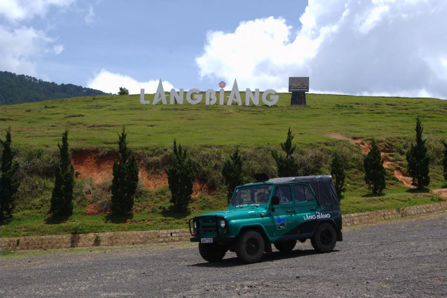
- By jeep. Green jeeps run up and down the steep paved road from the gate. It is quick, and you get most of your time at the top. Buy the ticket at the gate; the jeeps usually leave when they are full.
- On foot. You can walk up the same road. It is a few kilometres and steep all the way — allow roughly one and a half to two hours up for most people, less coming down. Bring water and a layer, because it is windy and cool at the top.
From Radar Hill you look out over Lac Duong, the Dan Kia and Suoi Vang lakes, and across the plateau to Dalat. On a clear morning you can see a long way.
Hiking to the summit
If you want the real top, a trail climbs through forest to the Lang Biang summit. It is a proper hike — steep, muddy after rain and easy to lose in places — and takes several hours there and back. Start early, tell someone where you are going, and consider hiring a local guide at the gate. Avoid it in heavy rain or thick cloud.
The K'ho villages and the legend
Lac Duong is home to the K'ho people, one of the Central Highlands' indigenous groups, and the name of the mountain comes from their story. It tells of K'Lang and H'Biang, a young man and woman from rival groups whose love was forbidden; when they died, their tears became the streams and the mountain took their names.
The villages at the foot of the mountain are ordinary places where people live and farm, not a show. Ride through quietly, ask before photographing anyone, and buy something from a local shop or a weaver if you want to support the community.
The Suoi Vang side
Lang Biang has a quieter western side. Ride west from Lac Duong through pine forest to Suoi Vang (Golden Stream) Lake and the Dan Kia reservoir, lakes in the hills that supply Dalat with water. The main roads are sealed, but red-dirt tracks lead off through the forest and the valleys. On a trail bike with some off-road experience they are a joy; on a scooter, stick to the tarmac, and in the wet season avoid the dirt altogether — the red clay turns to grease.
Our guided Lang Biang off-road tour is built around exactly these tracks: you ride your own Honda XR150 through the pine forest in the Lang Biang foothills, down to Suoi Vang Lake and out into the red-dirt valleys, with a guide who knows the way. Self-riders need an International Driving Permit (1968 convention, category A) and their home licence.
Best time of day
- Early morning: usually the clearest views, before cloud builds over the mountain. It can be cold at the top — bring a jacket even in the dry season.
- Midday: fine in the dry season (roughly November or December to April). In the rainy season, clouds often cover the top by late morning and afternoon storms are common.
- Sunset: popular at Radar Hill, and beautiful when it works. Remember you then ride back in the dusk; take it slowly and keep your lights on.
Weekends and Vietnamese holidays are busy. On a weekday morning you may have the view almost to yourself.
Make a day of it
Lang Biang fits easily into half a day. Add Suoi Vang for a full day, or combine it with the Valley of Love and the flower and strawberry farms on the way back into town — see our guide to day trips from Dalat and things to do in Dalat by motorbike. A scooter such as the Honda Vision is enough for the sealed road; for the dirt tracks, take the Honda XR150L. You pick your bike up at our shop in the centre of Dalat.
Planning this ride?
Send us your dates and route. We reply with which bike we would give you, and one total price.