
Guide · 5 min read
Dalat to Nha Trang by motorbike: the Khanh Le Pass route
By Motorbike Dalat ·
About 135 km on QL27C, from Dalat's pine forest over the Khanh Le Pass to the sea at Nha Trang. The road, the weather on the pass, where to stop, and how to ride it one-way.
The ride from Dalat down to Nha Trang is the one we get asked about first. It fits in a single day, it takes you from pine forest and cool air to palm trees and the sea, and the middle of it is a mountain pass that seems to go on for ever. Here is what the road is like, where to stop and how to do it without riding back.
The route at a glance
- Road: National Route 27C (QL27C), the road over the Khanh Le Pass
- Distance: about 135 km from central Dalat to central Nha Trang
- Riding time: most riders spend four to five hours in the saddle, plus stops — plan a full day
- Surface: sealed road the whole way, with long sections of tight bends and steep gradients on the pass
- Height change: from Dalat's plateau at roughly 1,500 m down to sea level
Leaving Dalat
The road climbs out of Dalat to the north-east, through vegetable farms, greenhouses and pine forest around Lac Duong, then runs into Bidoup – Nui Ba National Park. This first stretch is high, quiet and often cold in the early morning, so start with a warm layer on even if the forecast for Nha Trang says 30 °C.
Fill the tank before you leave town. Once you are in the national park and on the pass there is very little along the road — no reason to gamble on finding fuel. On a bike with a 12 L tank, such as the Honda XR150L or the CB150X, a full tank covers the whole trip comfortably. A scooter with a smaller tank will make it on paper, but top up again at the bottom of the pass anyway.
The Khanh Le Pass
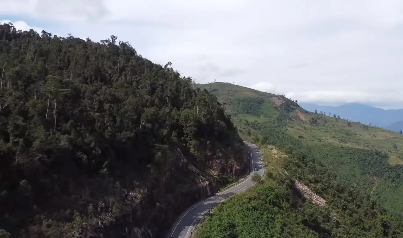
The pass itself is the reason people ride this road. It drops off the edge of the highlands in a long series of switchbacks, with forest on both sides and, on a clear day, views down the valley towards the coast. It is a proper mountain road, so ride it like one:
- Blind corners are everywhere. Vietnam drives on the right: stay well over to your side of the road on every bend, and expect a bus or truck to cut the corner coming the other way.
- Use your engine on the way down. On a manual bike, drop a gear or two and let the engine hold you back. On an automatic scooter, brake in short firm bursts with both brakes rather than dragging them the whole way down — hot brakes fade.
- Watch the surface. Gravel, leaves, water running across the road and the odd patch of repair work are normal, especially after rain.
- Cloud and fog sit on the top of the pass on many mornings. Lights on, speed down, and give it time to lift if you can't see.
After heavy rain, landslides have closed sections of this road in the past while crews clear them. If the weather has been bad, ask locally — or message us — before you set off, and be ready to take the longer way round (see below).
Where to stop
- Viewpoints on the pass. There are pull-outs where the valley opens up. Stop on a straight stretch, well off the road, never on the inside of a bend.
- Khanh Vinh. The first real town at the bottom of the pass, in the Cai River valley. Fuel, food and cold drinks — and the first taste of lowland heat.
- The Dien Khanh citadel. Just before Nha Trang, the old walls of the Dien Khanh citadel sit right by the road. Worth ten minutes.
- Nha Trang. The ride ends at the beach. The Ponagar Cham towers above the river mouth are a short hop from the centre.
Weather: two climates in one day
Dalat and Nha Trang do not share a rainy season. In Dalat most rain falls from about May to October, usually as afternoon downpours. On the Nha Trang side, the heaviest rain comes later in the year, roughly October to December, when storms from the South China Sea hit the central coast. That means autumn is when both ends can be wet at once, and when the pass is most likely to have problems.
The easiest months are generally from about January to August: dry or mostly dry on the coast, and only afternoon showers in the highlands from May. Whatever the month, leave early so you are over the pass before any afternoon rain, and pack a rain layer. Our guide to the best time of year to ride around Dalat has more detail.
The longer way round
If QL27C is closed, or you want a different road, you can ride east from Dalat through Trai Mat and D'ran, drop down the Ngoan Muc Pass towards Phan Rang, then head north along the coast on QL1 to Nha Trang. It is a good deal longer, the coastal highway is busy and the lowlands are hot in the afternoon, but it is a useful alternative when the Khanh Le Pass is closed. Check the current state of both roads before you choose.
Which bike?
The road is sealed all the way, so you do not need an off-road bike — but you will spend a long time going down steep hills, and a bike with gears and engine braking makes that easier. Riders who know what they are doing on a scooter take the Honda Air Blade 125; most pick the XR150L or CB150X for the extra ground clearance, bigger tank and luggage space. Whatever you ride, you need an International Driving Permit and your home licence — see our guide on whether you need an IDP to ride in Vietnam.
Doing it one-way
You do not have to ride back. With a one-way rental you pick the bike up at our shop in Dalat, ride to Nha Trang at your own pace — in one day, or two with a night somewhere on the way — and hand it to our partner there. We give you the drop-off address when you book, and we quote one total price for the bike, the days and the drop-off.
Would you rather sit back and let someone else do the riding? Our guided Dalat to Nha Trang tour takes a different, longer route over two days, through Lak Lake, Buon Ma Thuot's coffee country and down the Phoenix Pass, with you on the back of a local guide-rider's bike.
Planning this ride?
Send us your dates and route. We reply with which bike we would give you, and one total price.